Saturday, May 19, 2012

Ash Creek Falls


Although not an ascent into great elevation, nor a descent into the depths of the earth, this was one of the more physically and mentally taxing outings that I have been on.

The goal was to begin at the Brewer Creek trailhead and hike south, skirting the edge of the mountain until we (Alyssa and I) arrived at Ash creek. However just getting to the trailhead was difficult and confusing, in fact, we didn’t even make it there. The whole ordeal made me wonder about the value of paper maps, GPS units, and Google Maps. The car GPS unit which seemed to contain every road ever made, fictional or not, was calculating based off this and the shortest route possible. By following this, we ended up turning onto some ridiculous forest road, which eventually led us to an impassible creek. The problem with the Google Maps and the paper maps was that the road names did not match up. We eventually found the right roads, which were confirmed by signs every now and then that continued to point us in the right direction.

Soon we hit another inevitable barrier, although much sooner than we would of liked. SNOW

After driving over a few snow drifts, each one getting progressively deeper, when the next one had no end in sight. We were 5 miles and 1,400 feet short of the Brewer Creek trailhead.

With grey skies, a temperatures in the mid forties, and a slight breeze I was beginning to doubt whether we should try for the falls at all, but it is hard to turn back having come so far.

But I was nervous. Nervous like when giving a speech, which one has only rehearsed in their head before. I had never navigated with a topographical map before, and we didn’t even make it to the trailhead that I envisioned us being at. We were lost before we started, and without a compass. By comparing shape of the road on the car GPS unit to the roads on the map we were able to find where we were, and the general direction to head off in.

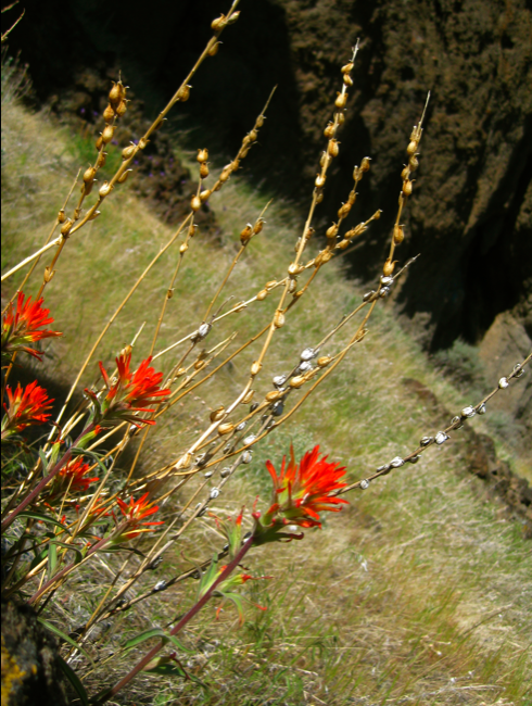
We began a beautiful snowshoe marathon. It really was a beautiful journey. It is not very often that one finds themselves in complete wilderness, without even the day old tracks of another human being for miles.

By trekking in a southern direction while always heading uphill I knew that we should be heading in the right direction, and eventually we would hit a significant ravine with Ash Creek at the bottom.

……….

3 hours and 34 minuets later, with a net gain of over 1,500 feet, via 4.82 miles of arduous snowshoeing we arrived. The falls were beautiful, and our exhaustion did not prevent us from appreciating the beauty of the scene before us. The canyon opened up as if God had drug an enormous pointed hoe down the mountain slope creating a 3-mile long trench that was at least 2,000 feet wide and must have been around 500 ft deep. The walls of the canyon were fraught with talus slopes, scared by the frequent rock and snow avalanches. It was raw.

Ash Creek flows down the east slope of Mt. Shasta out of the base of the Wintun Glacier, the third largest in California. The falls are a two step fall with a total distance of about 300 feet. The creek flows yearly, and depending on the snow pack one is typically able to cross the creek above elevations of 8,000 ft via a snow bridge until mid summer. We approached and viewed the falls from the north side, however a better view of the falls and canyon would be from the southern rim. Maybe next time, we still had quite a bit of snowshoeing for the return trip.
Instead of retracing our exploratory steps back to the car, I was able to use the Go To Location function on my Garmin Forerunner watch. Once set, it provided us with a compass, a heading, and a distance. We cut as straight of a line as possible in a northeastern direction following the guidance of the watch. Kudos to Garmin, the watch worked great. With combination of knowing where we were going as well as the downhill, we were able to cut off a full mile of meandering distance, and do those 3.86 miles in only 1 hour and 47 minutes.
8.86 miles and 5 hours 17 minuets of snowshoeing… the car was a very welcoming sight.
Another successful adventure well worth it. And Praise for my friend Alyssa, there are not many people willing to follow shoddy directions into the wilderness, and even after 4 miles of rough hiking with no end in sight, still be willing to continue. It was wonderful to have her along. I would not have done it without her.


Wednesday, May 16, 2012

Sheep’s Rock


The exploration of the underworld was not enough for us (Alyssa and I), so we continued out hwy. 97 towards another volcanic formation: Sheep Rock. Apparently the rocky prominence used to be occupied by herds of wild big horned sheep. This has been documented in numerous accounts by pioneers that traveled to northern California via the Applegate trail, a southerly alternative to the Oregon Trail.

The turn off for the trailhead is located on the left side of the 97 across from Military Pass Rd. The Yreka Trail that we travel on in order to get to the base of Sheep Rock was established in 1851 as a shoot off of the Applegate trail. Both of these roads, the Yreka Trail as well as Military Pass Rd., were originally Indian trails that were later used by the Hudson’s Bay Company trappers. The Military began accompanying the wagon trains along this road to protect them from the Modoc Indians, which is where the name Military Pass Road comes from. (source, first link)

Our ascent towards the top of Sheep Rock was stopped many times by the sheer rock cliffs. The manner in which the rock projects from the earth made it difficult to find a clear path to the top. Often we would hike around one pinnacle, only to find that we were on the edge of another cliff, or up against a rock wall again. Unfortunately I didn’t bring my GPS, otherwise I would be able to post a map that chronicled our zigzag—back tracing progress to the top. Our slow progress did however allow us the time to enjoy the scenery around us. We also found some bones. They were quite sun bleached, and growing lichen, perhaps it was the last sheep on Sheep Rock.

Indian Paintbrush
Radius and Metacarpus


Rare Baker Cypress
Mt. Shasta does an effective job at blocking the storms that primarily approach from the southwest. The effect of this leaves the northeast lands in its rain shadow creating a high desert climate despite the location's higher elevation than that of Dunsmuir, Mount Shasta, and Weed. The hot dry land made us wish for the cool dim caves just a few miles away.
Northface with views of the Bolom and Hotlum glaciers 
The peak provided us with a spectacular view of the mountain from almost due north, as well as the dry grasslands lands around Sheep Rock. It was pretty neat being surrounded by undeveloped wilderness in an area that has not changed much at all in the last few hundred years.
Stone arch about half way up
The entrance to our decent in this gorge

Pluto’s Cave


Siskiyou County has quite a few unique volcanic formations. This time my friend Alyssa and I explored a 180,000 year old Lava tube.

We started at 11am heading towards a cave called Pluto’s Cave (not to be confused with Plato's Cave) located off of highway 97 about 12 miles outside of Weed, CA. It was a little rough getting there despite having good directions because most all of the roads are cinder, and not labeled well, also having a slick wheeled 4 cylinder Toyota Corolla does not do well off roading. Never-the-less we arrived.

The first cave smelled strongly of urine, we were hoping that the smell was due to animals rather than humans, this was confirmed when we found a healthy scattering of fresh looking bat guano over a decent portion of the rocks. Neither of us had ever seen bat guano in person before, however the fall pattern, the fact that we were in a cave, and seeing a bat were all pretty good indicators. (I also compared the image below with other images on the internet and they were the same)

Lava tubes such as this one are formed when the outer edges of the lava flow cool, crusting over yet then providing insulation to the inner lava so that it can continue to flow to the eruption, or dissipation point. Although undoubtedly discovered hundreds of years earlier, the cave is named by Nelson Cash Who in 1863 stumbled upon it while tending to his cattle. Cash fittingly named it after the Roman God of the underworld: Pluto.

The Cave continues for about a quarter mile. There are three breaks in the ceiling, two of which occurred many years ago and now provide some welcomed greenery (as seen in the first two images) in the otherwise arid climate. The other collapse is more recent and without any new growth.

 The cave was a fun outing, although not as extensive as the Lava Bed National Monument, nor as nerve racking as Hell Hole in Santa Cruz, it is still a worthy destination. It is always interesting to descend into the cool darkness of the underworld.

Sunday, May 13, 2012

Helen Lake Hike

Having spent 9 months in the Mt. Shasta area, I decided it was about time I started going for some adventures. I used Black Butte as a conditioning hill the previous week running/hiking up in 40min, and then running down in 25min. It is a nice 2.5 mile hike up.

Today I left after church around 2pm and drove up to Bunny Flat (6900'), I brought my old Camelbak Mule, which was well stocked with water, food, tools, and some emergency medical supplies. I realized that I completely forgot my jackets, and fleeces, which almost had me considering to turn back since it was now 2:30pm, and I would be climbing up without the proper attire, but I said almost.


I lathered up in sunscreen (except I forgot the reflection of the sun off the snow, and didn't get my neck which is now fried!), put my hat and sunglasses on, and strapped on my snow shoes. I was off.

And when I go for something, I am really going for it. I charged up the mountain like it was a interval workout, and soon found out that I need more frequent breaks than I had expected.

Although Black Butte rises from 4500' to 6300', and running up and down in boots and pack is no easy feet, it didn't quite prepare me for the oxygen sucking ordeal that I had embarked on. I think running up black butte in snow shoes, pants, jacket while breathing through a snorkel might have been better prep work.

It was plenty warm, and oddly their was very little wind therefore I was able to continue the ascent despite only wearing a long sleeve T-shirt. The downfall of the warm was that it made the snow quite soft. In fact the weather was so nice, that the snow was still pliable at 10,450'. Before long I was above the tree line moving along nicely. It took me 2 hours and 20mins to reach Helen Lake at 10,450'.


 Helen Lake looks like it is a popular place to camp for the night and then do the final ascent the following day, rather than starting around 3am and traversing the whole thing in one go. When chatting with the climbers that were coming down, it was always easy to tell who made it a two day adventure via camping, or who started before the sun rose. The one dayers would typically begin the conversation with "Where is the trail head?" or "How much further?"They were exhausted.

The decent was quick, 50min quick, It was a combination of running in my snowshoes, falling all over the place, and sliding on my butt (technically called Glissading).

There was quite a bit that could of gone wrong with the whole day, but that has provided me with a vast supply of things to change and improve on for next time.

On my next outing I would like to have skis or snowblades so that the decent is quicker and easier in the areas that allow it. I would like to refrain from forgetting my extra clothing. I would like to practice how to use an ice axe effectively. I would like to give myself more time (beginning a climb at 2:30pm leaves no time for mishaps, or emergencies with nightfall approaching, and considering the waning light one is more likely to rush against the setting sun providing a much greater chance of an avoidable emergency) Finally I would like to have a partner, it is really never a good idea to go out on ones own, and it is always much more enjoyable when you can share the experience with another person. Oh and I would like to take better pictures and a video too.